The Global Positioning System (GPS) allows a person to locate his or her position anywhere on the planet, at any time, using a small handheld receiver. Originally developed as a military project, GPS has now reached every corner of civilian life. Today it is not only an essential tool in ships and aircraft, but it is also becoming, due to its multiple applications, a common feature in vehicles as well as in athletic and scientific equipment.
Features:
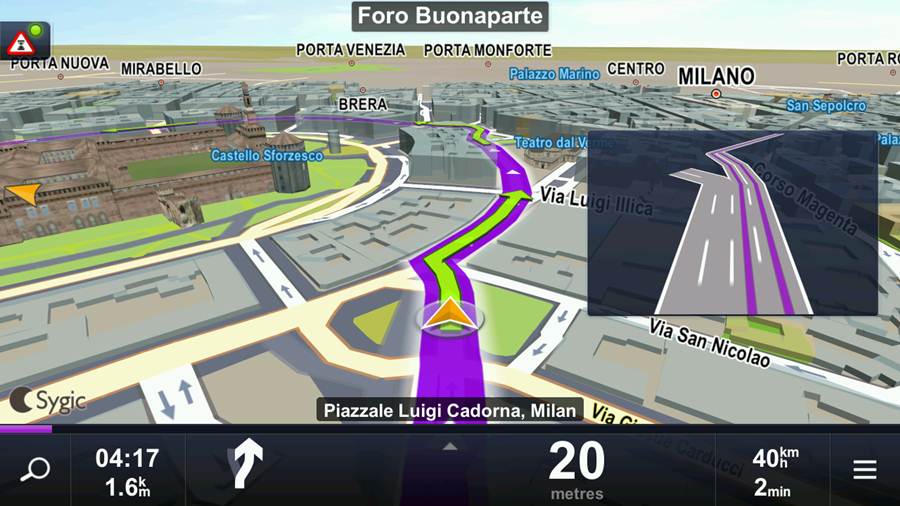
Since GPS is a dynamic system, it also provides real-time data about the movement, direction , and speed of the user, allowing for large number of user.
1.Location
 The civilian user determines his or her position using three- dimentional geographic coordinates, with a margin of error between 7 and 50 feet (2-15m) depending on the quality of the receiver and the satellite it detects at any given moment.
2.Maps
Extrapolation of the coordinates using geographic charts of cities, roads, rivers, oceans, and airspace can produce a dynamic map of user's position and movement.
3.Tracking
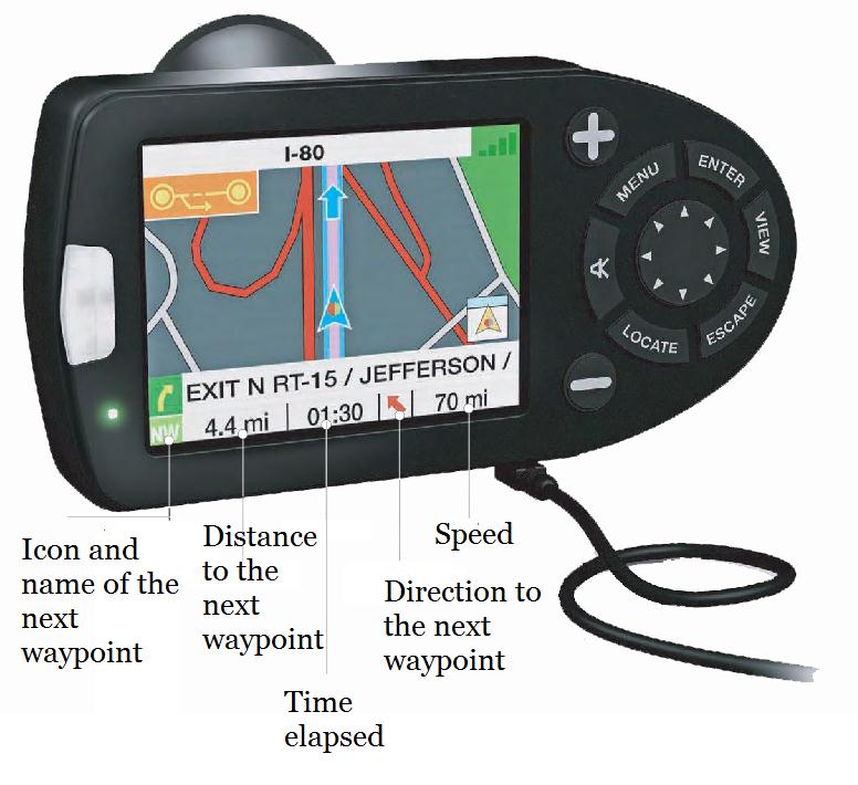
the user can know the speed at which he/ she is traveling, the distance travelled. and the time elapsed. In addition, other information is provided, such as average speed.
4. Trips
Trips can be programmed using predetermined points (waypoints). During the trip, the GPS receiver provide information about the remaining distance to each waypoint, the correct direction, and the estimated time of arrival.
APPLICATION
Although it was originally developed as a navigational system. GPS is used today in a variety of fields. The free use of this tool for work, business, recreation and sports activities is changing the way we move and act.
Way of Working
The Navstar GPS satellite are the heart of the system. The satellite emit signals that are intercepts by the GPS receiver to determine its location on a map. The System has a constellation of 24 main satellites that orbit the earth at an altitude of 12,550 miles(20,200Km) collectively covering the entire surface of the planet. They circle the earth every 12 hours.
1.The receiver detects one of the satellite and calculates its distance. This distance is the radius of a sphere whose center is the satellite and on whose surface the user can be located, although at a point yet to be determined.
2.When a second satellite is detected and the distance calculated, a second sphere is formed that intersects with the first sphere along a circle. The user can be located anywhere along the perimeter of the circle.
3. A third satellite forms a third sphere that intersects the circle at two points. one as an invalid location (for example, a position above the surface of the earth). The other points is the correct location. The more satellite used, the lower the margin of error.
Calculating The Distances
Way of Working
The Navstar GPS satellite are the heart of the system. The satellite emit signals that are intercepts by the GPS receiver to determine its location on a map. The System has a constellation of 24 main satellites that orbit the earth at an altitude of 12,550 miles(20,200Km) collectively covering the entire surface of the planet. They circle the earth every 12 hours.
1.The receiver detects one of the satellite and calculates its distance. This distance is the radius of a sphere whose center is the satellite and on whose surface the user can be located, although at a point yet to be determined.
 |
 |
 |
Calculating The Distances
1.The receiver has in its memory the satellites' ephemerides (from the Greek word ephemeros, meaning “daily”)—that is, their position in the sky by the hour and day
2.Upon detection of a satellite, it receives a highly complex signal of on-off pulses called a pseudo-random code.

3.The receiver recognizes the code and the exact time of each repetition (the signal includes corrections to the receiver's clock). By means of comparison, the receiver determines the lag in the satellite's signal, and since it knows the signal's speed, it can determine the distance
No comments:
Be the First to Comment ↓